Popular Posts

Showing posts with label mountain and lakes. Show all posts

Friday, 13 September 2024

Buldhana District


Buldhana District, located in the state of Maharashtra, India, has a rich historical background. The district derives its name from the city of Buldhana, which is also its administrative headquarters. Historically, Buldhana has been a significant region, with its roots tracing back to ancient times. It was part of the Vidarbha region, which finds mention in early Hindu scriptures and epics. Over the centuries, Buldhana was under the rule of various dynasties, including the Satavahanas, Vakatakas, and Rashtrakutas. The region was later influenced by the Mughal Empire and subsequently became part of the Maratha Empire under the Peshwas. Post-independence, Buldhana was incorporated into the state of Maharashtra in 1960.


Geography of Buldhana District

Geographically, Buldhana District is situated in the western region of Vidarbha, bordered by the districts of Jalgaon and Akola to the north, Jalna to the west, and Washim to the south. The district covers an area of approximately 9,644 square kilometers and is predominantly hilly, with the Satpura Range extending across its northern boundary. The region is characterized by a mix of fertile plains and rugged terrain, with the Purna and Penganga rivers serving as the primary water sources. The climate of Buldhana is tropical, with hot summers, moderate monsoons, and cool winters. The average annual rainfall ranges between 700 to 1,000 mm, contributing to the district's agricultural economy. 

Cultural Significance of Buldhana District

Buldhana District is a melting pot of cultural influences, reflecting the diverse heritage of Maharashtra. The district is known for its traditional festivals, folk music, and dance forms, which are deeply rooted in the customs and beliefs of the local population. Ganesh Chaturthi, Diwali, and Makar Sankranti are celebrated with great fervor across the district. The local dialect is Marathi, and the people are known for their warm hospitality. The district also boasts a rich tradition of arts and crafts, including textile weaving, pottery, and metalwork. The cultural practices of Buldhana are closely tied to the agrarian lifestyle of its residents, with many festivals and rituals centered around the agricultural calendar. 

Tourist Destinations in Buldhana District

Buldhana District offers several tourist attractions that draw visitors from across the state and beyond. One of the most famous destinations is the Lonar Crater, a unique geological formation created by a meteorite impact around 52,000 years ago. The crater, now filled with saline water, is surrounded by temples and is considered a site of both scientific and religious significance. Another notable destination is the Gajanan Maharaj Temple in Shegaon, a major pilgrimage site dedicated to the revered saint Gajanan Maharaj. The temple complex attracts thousands of devotees every year. Additionally, the Rajur Ganpati Temple, located in the town of Rajur, is another popular pilgrimage site in the district. 

The district also offers natural attractions such as the Sindkhed Raja, the birthplace of Jijabai, the mother of Chhatrapati Shivaji Maharaj. The historical fort of Sindkhed Raja and the adjacent lakes and gardens make it a destination of historical and scenic interest. The Satpura hills and the Purna River also provide opportunities for trekking, bird watching, and other outdoor activities. 

Buldhana District is a region that beautifully blends history, culture, and natural beauty. From its ancient historical significance to its vibrant cultural traditions and diverse tourist destinations, Buldhana offers a unique experience to visitors and residents alike. Whether it is exploring the geological wonder of Lonar Crater or seeking spiritual solace at Shegaon's temple, Buldhana District stands out as a significant region in Maharashtra.

Thursday, 12 September 2024

Lakes in Jharkhand

 Jharkhand, a state in eastern India, is known for its diverse natural resources, including its lakes, which play a crucial role in maintaining the region's ecological balance. These lakes in Jharkhand serve as important water bodies that support biodiversity, provide water for irrigation, and contribute to the local climate regulation.


1. Kanke Dam Lake

Located near the capital city of Ranchi, Kanke Dam Lake is a prominent lake in Jharkhand. It is situated in the Kanke area, approximately 8 kilometers from Ranchi city center. The lake was constructed primarily to supply water to the nearby areas, but over time, it has become a vital habitat for various aquatic species. The lake supports a range of flora and fauna, making it an essential component of the local ecosystem. Additionally, it serves as a source of freshwater for irrigation, which is crucial for the agriculture-dependent communities in the region. 

2. Dimna Lake

Dimna Lake, located near Jamshedpur in the East Singhbhum district, is an artificial reservoir created by the Tata Steel company. The lake is situated at the foothills of the Dalma Range, about 13 kilometers from Jamshedpur. Dimna Lake is primarily used as a water supply source for the city of Jamshedpur and its industrial operations. Ecologically, the lake plays a significant role in maintaining the local biodiversity by providing a habitat for various aquatic and terrestrial species. The surrounding forests of the Dalma Wildlife Sanctuary further enhance the ecological importance of Dimna Lake. 

3. Ranchi Lake

Ranchi Lake, another important lake in Jharkhand, is located in the heart of Ranchi city. The lake was excavated in 1842 by a British official named Colonel Onsley. Over the years, Ranchi Lake has become an integral part of the city's landscape, providing a scenic environment and a habitat for various bird species. The lake also helps in groundwater recharge, which is vital for maintaining the water table in the urban areas of Ranchi. 

4. Maithon Lake

Maithon Lake, located in the Dhanbad district, is part of the Maithon Dam project, which was constructed on the Barakar River. The lake is situated about 48 kilometers from Dhanbad city. Maithon Lake plays a crucial role in flood control, irrigation, and hydroelectric power generation in the region. The lake's extensive surface area and surrounding greenery support a rich biodiversity, including several species of fish and migratory birds. The ecological importance of Maithon Lake is further highlighted by its contribution to the region's climate regulation and water management. 

5. Panchghagh Lake

Panchghagh Lake is located near the town of Khunti, around 55 kilometers from Ranchi. The lake is formed by a series of waterfalls on the Banai River, creating a natural water reservoir. Panchghagh Lake is not only a popular tourist destination but also an important ecological site. The lake supports a variety of aquatic life and provides water for the surrounding agricultural lands. Its natural setting amidst dense forests makes it a critical habitat for local wildlife and contributes to the ecological stability of the region. 

The lakes in Jharkhand are more than just water bodies; they are vital ecological assets that contribute significantly to the state's environment. From supporting biodiversity to providing water for irrigation and urban use, these lakes play a crucial role in maintaining the ecological balance of the region. Protecting and preserving these lakes is essential for sustaining the natural environment and ensuring the well-being of the local communities that depend on them.

Wednesday, 11 October 2023

Rivers of the Deccan Region in India


The Deccan region of India, known for its rich cultural heritage, diverse landscapes, and historical significance, is also home to several significant rivers that play a vital role in the lives of its people. Stretching across the southern part of the Indian subcontinent, the Deccan plateau is crisscrossed by numerous rivers, each with its unique characteristics and contributions. In this article, we will explore the major rivers that flow through the states of Telangana, Tamil Nadu, Kerala, Andhra Pradesh, Maharashtra, Karnataka, and even the tiny state of Goa, painting a vivid picture of the aquatic lifelines that sustain these regions.


Rivers of Telangana

Telangana, a relatively young state in India, is blessed with several rivers that originate in the Western Ghats and flow through its undulating terrain. Among these, the Pranahita River stands out as one of the major tributaries of the Godavari. It joins the Godavari at Kaleshwaram and is crucial for irrigation and drinking water supply in the state. Another notable river in Telangana is the Dindi River, which originates in the Mahbubnagar district and eventually merges with the Krishna River in Andhra Pradesh. These rivers not only provide sustenance but also contribute to the state's natural beauty. 

Rivers of Tamil Nadu

Tamil Nadu, located in the southernmost part of the Deccan plateau, boasts a network of rivers that crisscross the state. The Thamirabarani River, originating in the Western Ghats, flows through the Tirunelveli and Thoothukudi districts, supporting agriculture and providing drinking water to the region. The Kollidam River, a distributary of the Cauvery River, plays a crucial role in draining excess water from the main river during the monsoon season, preventing floods. The Vaigai River, flowing through Madurai, is significant for its historical and cultural importance. However, over-exploitation and pollution have posed challenges to the health of these rivers. Additionally, the Cooum River and the Adyar River, flowing through Chennai, face severe pollution due to urbanization and industrialization. 

Rivers of Kerala

The lush state of Kerala is known for its abundant natural beauty, and its rivers are an integral part of this scenic landscape. The Pamba River, originating in the Western Ghats, is revered for its association with the Sabarimala temple and supports extensive agriculture in the region. The Chaliyar River, on the other hand, flows through the districts of Malappuram and Kozhikode and is known for its picturesque beauty. The Meenachil River, originating in the Western Ghats, flows through the Kottayam district, contributing to the fertility of the land. Kerala is also home to the Bharathapuzha River, Chalakudy River, and Bhavani River, each with its unique ecological significance. However, like many other rivers in India, pollution and encroachments pose a threat to these water bodies. 

Rivers of Andhra Pradesh

Andhra Pradesh, with its diverse topography, hosts a variety of rivers that cater to the needs of its people. The Vamsadhara River, originating in the Eastern Ghats, flows through the districts of Srikakulam and Vizianagaram before entering Odisha. It is an essential water source for both states. The Wainganga River, though mainly flowing through Maharashtra, forms a part of the border between Maharashtra and Andhra Pradesh. These rivers play a vital role in sustaining agriculture and supporting livelihoods in the state. 

Rivers of Maharashtra

Maharashtra, with its mix of bustling cities and serene rural landscapes, is crisscrossed by numerous rivers. The Kukadi River, originating in the Western Ghats, flows through Pune and Ahmednagar districts, supporting agriculture and industry. The Koyna River, an important tributary of the Krishna, is known for the Koyna Dam and the hydroelectric power generated from it. The Ulhas River, flowing through the Mumbai Metropolitan Region, faces pollution issues but remains significant for its historical importance. The Manjira River, Indrayani River, Savitri River, Penganga River, Ghataprabha River, Wardha River, Purna River, Pravara River, Mula River, Girna River, Mutha River, and Kanhan River are some of the other rivers that crisscross the state, contributing to its water resources and agricultural productivity. 

Rivers of Karnataka

Karnataka, known for its diverse landscapes and rich cultural heritage, is blessed with a multitude of rivers. The Malaprabha River, originating in the Western Ghats, flows through the Belgaum and Bagalkot districts, providing irrigation for agriculture. The Netravati River, in the Western Ghats, flows through Dakshina Kannada, contributing to the region's lush greenery. The Bhadra River, known for the Bhadra Wildlife Sanctuary, is crucial for wildlife conservation. The Tunga River, Vedavathi River, Varahi River, Kumaradhara River, Hemavati River, Palar River, Sharavati River, Ponnaiyar River, Shimsha River, Nira River, and Daman Ganga River are among the other rivers that traverse the state, enriching its natural resources. 

Rivers in Goa

Although the smallest state in India, Goa is not devoid of its share of rivers. The Zuari River is one of the prominent water bodies in Goa, flowing through the state before joining the Arabian Sea. It plays a significant role in the state's ecology and is home to diverse aquatic life. 

The Deccan region of India, with its diverse states, is abundantly blessed with rivers that contribute to its agricultural, industrial, and cultural heritage. However, these rivers face numerous challenges, including pollution, encroachment, and over-exploitation. It is essential for the governments and communities in these states to come together to protect and preserve these vital lifelines for the sake of current and future generations. The rich history, culture, and livelihoods of the Deccan region are intricately linked to its rivers, making their conservation a matter of utmost importance.

Wednesday, 3 May 2023

Tungabhadra River: A Source of Culture, Economy, and Inspiration


The Tungabhadra River is a significant river that flows through the Indian states of Karnataka and Andhra Pradesh. The river's course is approximately 531 kilometers long, and it originates in the Western Ghats mountain range. The river's name is derived from two Kannada words, "Tunga," which means "good" and "Bhadra," which means "auspicious."


This article covers:

  • History and Mythology
  • Course and Geography
  • Significance and Importance
  • Economic and Cultural Importance

 History and Mythology

The Tungabhadra River has a rich history that dates back to ancient times. It was one of the most important rivers during the Vijayanagara Empire, which ruled South India from the 14th to the 16th century. The river served as a major transportation route for the empire's army and also played a crucial role in the empire's trade and commerce. According to Hindu mythology, the Tungabhadra River is associated with the legendary saint Rishi Jamadagni and his wife Renuka.

 Course and Geography

The Tungabhadra River originates at an altitude of 1,295 meters above sea level near the village of Kudli in the Western Ghats. It then flows in a south-easterly direction through the districts of Shimoga, Davangere, Haveri, and Bellary before joining the Krishna River at Kurnool in Andhra Pradesh. The river's course is characterized by a series of rapids and waterfalls, which make it a popular destination for adventure enthusiasts.

 Significance and Importance

Apart from its religious significance, the Tungabhadra River is also economically important for the region. The river provides water for irrigation and is a major source of drinking water for the people living in the region. The river also serves as a source of hydroelectric power, with several hydroelectric power stations located along its course.

 Economic and Cultural Importance

The Tungabhadra Dam, which is located near the town of Hospet in the Bellary district, is one of the most important dams on the river. The dam was built in 1953 and is used for irrigation, drinking water supply, and hydroelectric power generation. The dam is also a major tourist attraction, with thousands of tourists visiting it every year. The river continues to be an important part of the region's economy and is a source of livelihood for millions of people living along its banks.

 The Tungabhadra River has played a significant role in the region's history and culture. It has been a witness to the rise and fall of several empires and has served as a source of inspiration for artists and writers throughout the ages. The river's religious and cultural significance, coupled with its economic importance, makes it a vital resource for the people living in the region. As such, it is imperative that we take steps to preserve and protect this valuable resource for future generations.

For more, visit the link below:

https://www.indianetzone.com/14/tungabhadra_river.htm

River Teesta


The Teesta River is one of the major rivers in India, flowing through the states of Sikkim and West Bengal. It is a tributary of the Brahmaputra River, and originates from the Himalayas. The river flows through a distance of about 309 km in India, and its basin area is approximately 12,159 km2. The Teesta River is significant for its ecological, cultural, and economic value. It is also popular among tourists for its scenic beauty, water sports, and adventure activities. 

The Teesta River originates from the Tso Lhamo lake, which is situated at an altitude of about 5,330 meters in the Himalayas. The river then flows through Sikkim, where it is joined by its major tributary, the Rangeet River. The Teesta River enters West Bengal at Sevoke, and then flows through the Darjeeling district, where it forms the border between India and Bangladesh. Finally, the river empties into the Brahmaputra River, which flows into the Bay of Bengal.

 The Teesta River is a popular destination for water sports and adventure activities. The river offers opportunities for rafting and kayaking, and several adventure sports companies offer packages for tourists. The river's rapids are graded between 2 and 4, making it suitable for both beginners and experienced rafters. The river's scenic beauty, with its lush green forests, snow-capped mountains, and picturesque villages, adds to the charm of the water sports experience.

The Teesta River is an important source of hydropower, and several dams and hydroelectric projects have been built on the river. The Teesta Valley Power Project, which is a joint venture between the Government of Sikkim and the NHPC Limited, is the largest hydroelectric project on the Teesta River. The project has a total installed capacity of 1,200 MW and consists of four power stations. The Teesta Urja Limited is another major hydropower project on the river, with a capacity of 510 MW.

The construction of these dams and hydroelectric projects has led to concerns about their impact on the ecology and environment of the river. The projects have altered the flow of the river, and have led to the displacement of local communities. There have also been concerns about the impact of the projects on the river's biodiversity.

The Teesta River is a significant river in India, with its ecological, cultural, and economic importance. It is also an important source of hydropower and a popular destination for water sports and adventure activities. However, the construction of dams and hydroelectric projects on the river has led to concerns about their impact on the environment and local communities. It is important to ensure that these projects are implemented in a sustainable and responsible manner, with adequate measures in place to mitigate their impact on the river's ecology and the livelihoods of local communities.

 For more, visit the link below:

https://www.indianetzone.com/14/teesta_river.htm


Friday, 28 April 2023

River Chenab

 The Chenab River is one of the five major rivers of the Indian subcontinent. It is located in the northern region of India and has a length of around 960 kilometers. The river originates from the Himalayas in the state of Himachal Pradesh and flows through Jammu and Kashmir and Punjab before finally joining the Indus River in Pakistan.


The Chenab River is an important part of the culture and history of India. It has been mentioned in various ancient Indian texts, including the Rigveda and the Mahabharata. The river is considered holy by the people of the region and is believed to have great spiritual significance. Many temples and shrines are located along the river, and it is a popular destination for religious pilgrims.


The river has its source near the Baralacha La pass, at an altitude of around 4,900 meters above sea level. From there, it flows through the Lahaul and Spiti Valley and enters Jammu and Kashmir. In Jammu and Kashmir, the river flows through the districts of Doda, Kishtwar, Ramban, and Reasi. It then enters the plains of Punjab and flows through the districts of Jalandhar, Ludhiana, and Multan before entering Pakistan. 

The Chenab River has also played an important role in the history of the region. The river valley was home to several ancient civilizations, including the Harappan civilization. The region has also been the site of numerous battles and invasions over the centuries. The river valley was a major trade route during the medieval period, and many towns and cities developed along its banks. 

Apart from its cultural significance, the Chenab River also plays an important role in the economy of the region. The river is a major source of water for irrigation and is used extensively for agriculture in the region. The fertile plains of Punjab, through which the river flows, are known for their high agricultural productivity. The river also has significant hydroelectric potential and is the site of several hydroelectric projects, including the Dulhasti and Baglihar dams. 

Chenab River is an important part of the culture, history, and economy of India. It has played a significant role in the development of the region, and its waters have been used for agriculture, hydroelectricity, and transportation. The river valley has been home to several ancient civilizations, and the river is considered holy by the people of the region. However, the river faces several challenges today, and it is important that steps are taken to preserve and protect it for future generations.

For more, visit the link below:

https://www.indianetzone.com/7/chenab_river.htm

Thursday, 23 March 2023

South Indian States


South Indian StatesSouth Indian states include TelanganaAndhra PradeshTamil NaduKarnataka and Kerala. These South Indian states are covering the southern part of the peninsular Deccan Plateau. These states are bounded by the Bay of Bengal in the east, the Arabian Sea in the west and the Indian Ocean in the south. The geography of the region is diverse with two mountain ranges - the Western Ghats Mountain Range in India and Eastern Ghats Mountain Range in India, bordering the plateau heartland. 

History of South Indian States
Vijayanagara Empire was the last dynasty to rule the region and post that southern Indian has been through multiple invasions. Delhi Sultanate led to the fall of Vijayanagara Empire and eventually captured the region and ruled as Deccan Sultanate. The region was later invaded by the Marathas, Palaiyakkarars, and Nayaks. Southern India was initially colonized by the Europeans in the 15th Century and by the mid 18th Century the French and British constantly fought over for control of that region. After several battles like the Anglo-Mysore war and the Vellore Mutiny, the British took control over that region in 1857 with exception of Pondicherry (now Puducherry) which remained under French rule. The British Empire divided the region into a few states and presidencies such as Madras PresidencyHyderabad State, MysoreTravancore, Cochin, and Jeypore.

For more, visit the link below:

Friday, 27 January 2023

Natural Valleys of Uttarakhand


Natural Valleys of UttarakhandSmall valleys and perennial rivers of Uttarakhand offer wonderful experience to nature lovers and hikers. The vast open hay field, above the tree line present endless views of the variously coloured Himalayan flowers. The most interesting of them, aesthetically or botanically are seen in the higher altitudes, from 2,450 metres and above. The arrival of spring brings forward an uprising of colours, when flowers like the Semal and Palash put the lower altitude forests on fire with their blazing red flowers. It is also the time for Burans to spread its fire at a height of or above 2,450 metres adding colour to the blue and white panorama of snow. The flowers do not grow only in the Valley of Flowers but are found on different treks habitually up to great heights as also on the hay field and even in rock cracks or moraines. Some of the most interesting and floristically rich natural valleys of Uttarakhand are:

Har ki Doon Valley: Situated deep inside the Govind Pashu National Park, the Har ki Doon Valley is one of the most beautiful valleys in the Western Himalayas. It is nestled in the middle of a cradle-shaped vale below the Har Ki Dun peak. Known for its rich variety of flora and fauna, the trail through alpine meadows, moraine ridges, glacier basins, pine forests and ancient villages, gives the travellers and hikers a spectacular view of the valley. The Har ki Doon Valley is situated in the lying strip of Rawain sub-division of the Uttarkashi district. It is a unique valley expanding about 7 to 8 km at an altitude of 3,566 m. To reach Har-ki-Doon from Uttarkashi one passes through the Barkot Purola, Netwar and Taluka villages.

Kuthi Valley: The picturesque locations of the Kuthi valley are a delight for the mountaineers, trekkers, adventure seekers, botanists, sightseers, tourists and pilgrims. The Pithoragarh district which houses the Kuthi valley is one of the prominent halt for the people proceeding to the famous Kailash Mansarovar Yatra route. The rivers in the Kuthi valley provide excellent scope for organizing water sports, rafting etc. The region surrounding the Kuthi valley and the district of Pithoragarh are called as 'Miniature Kashmir'. The valley lies in the eastern part of Uttarakhand and is joined to the Darma Valley via the Sinla and Nama pass. The highest mountain peak occupying this valley is Baba Kailash, with a height of 6,191 m. The Kuthi Valley is inhabited by the Bhotiya tribes who are found in many of the High Himalayan valleys.

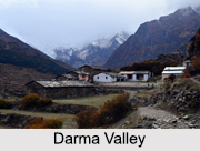
Natural Valleys of UttarakhandDarma Valley: The undulating picturesque landscape of the Darma Valley is interspersed with verdant forests, captivating waterfalls and streams, along with magnificent alpine meadows which host colourful wild flowers. The valley is formed by the Darma River also known as the Dhauli Ganga which meanders through the valley. The trekking trail passes through spellbinding vistas, seasonal glaciers, coniferous forests, broad fields, picturesque hamlets, and more.

Saur Valley: A small valley in the Pithoragarh district, the Saur Valley stretches for about 8 km and is about 5 km wide. It is surrounded by beautiful mountains, slopes gently to the south-east, and is bisected into north and south by a tubular ridge of slate, limestone and greenstone originating in the mountains to the north-west and branching down to the south-east. Nestled at an altitude of 1,650 m, the valley offers panoramic views of the vast snow range extending across Trishuli, Nanda Devi, Panchchuli Group, and Adi of Nepal from a place named Chandak.

For more, visit the link below:

Friday, 20 January 2023

Forts in Raigad District, Maharashtra


Forts in Raigad District, MaharashtraForts in Raigad district, Maharashtra, are the ancient monuments built by different rulers to protect the royal families and their subjects. Surrounded by huge walls, these forts exhibit impressive architecture in terms of defence as well as artistry. Although much part of the forts has been ruined over time, they still display their former grandeur among the relics. Forts in Raigad district unfold various events of Indian history and form alluring tourist spots. These massive forts have been the witness of numerous battles and have changed many possessions. Several constructional features have also been added to them with time.

Avchitgad Fort
Avchitgad fort is a hill fort located over the Sahyadri ranges near Roha in Raigad district. Medha is a village situated at the base of the fort. It is believed to have constructed by Shilahar kings. Reconstruction work had been done in the fort by the great Maratha king Chhatrapati Shivaji. Dense forests surround this fort.

Karnala Fort
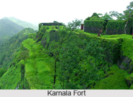
Karnala fort, also famed as Funnel Hill, is located in Raigad district near Panvel city. It stands within Karnala Bird Sanctuary and is a protected monument. The possession of the fort changed many hands. It is in fact a combination of two forts standing at different elevations. It houses two inscriptions in Persian and Marathi.

Kolaba Fort
Forts in Raigad District, MaharashtraKolaba fort is an ancient military fortification situated near the shores of Alibaug. It has been declared as a protected monument and serves as a popular tourist destination. A unique feature of the fort is the freshwater wells in the fort premise in spite of its location near the sea. It also shelters a Siddhivinayak temple which was built in 1759 by Raghoji Angre.

For more, visit the link below:

Friday, 13 January 2023

Hill Stations of Madhya Pradesh


Hill Stations of Madhya PradeshHill stations of Madhya Pradesh cover the hilly areas of rocky beauty mixed with history and nature. Famous Hill stations of Madhya Pradesh are Pachmarhi, Amarkantak, Shivpuri and KundeshwarMadhya Pradesh is a beautiful part of central India, serving as a great combination of hill stationstrekkingspots and wildlife sanctuaries. These hilly destinations mostly enjoy dry climate, so one need to visit here in retreating monsoon time.

The following are the Hill Stations of Madhya Pradesh:

Pachmarhi
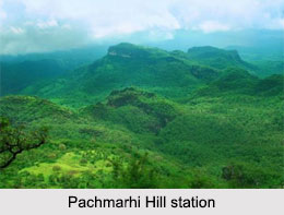
Pachmarhi, in Hoshangabad districtis a famous hill station not only in Madhya Pradesh, but also it is popular in Central Indian States. Pachmarhi came into existence with the establishment of ‘Pachmarhi Cantonment’ from the rule of British Empire in India. It is widely known as “Satpura ki Rani” or the “Queen of Satpura”. Dhupgarh is the highest point in Madhya Pradesh. Satpura Mountain Range is also located here. Bee Falls, Chauragarh, Dhupgarh, Jatashankar and Pandava caves are the popular destinations in Pachmarhi.

Amarkantak
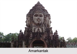
Amarkantak, located in Anuppur Districtis a pilgrimage town and the small hilly land in Madhya Pradesh. Amarkantak is located under the division of Anuppur District of Madhya Pradesh. This destination is considered as “Teerthraj” or the “King of Pilgrimages”. This region is an exclusive natural heritage area. It is the meeting point of the Vindhyasand the Satpuras, along with the Maikal HillNarmada RiverSon River and Johila River appear from the meeting points of these two mountain ranges.
Hill Stations of Madhya Pradesh
Shivpuri
Shivpuri, in Shivpuri District is popular for the lush green forests, waterfalls, hills and the lakes. Located in the Shivpuri district of Madhya Pradesh, this hill station offers one to find peace in the midst of the dense jungles. Chattri, Madhav National Park, George Castle and Madhav Vilas Palace are the popular places in Shivpuri.

Kundeshwar
Kundeshwar, in Tikamgarh District is a small hilly village situated in Tikamgarh District. This place is popular for the presence of an ancient temple dedicated to Mahadeva. The temple is located in the midst of the dense jungle. There is a waterfall named Usha waterfall, located in this region.

For more, visit the link below:

Wednesday, 23 November 2022

Tourism In Bihar


Tourism In BiharTourism in Bihar comprises of both the nature tourism and pilgrimage tourism, that attracts Indians and the tourists outside India. Bihar, in North India, is full of tourist attractions. Being one of the oldest inhabited places in the world with history of three thousand years, it becomes the hub of Buddhist architecture. The state has rich culture and heritage which is depicted in the numerous ancient monuments that dots the place. Tourism in Bihar is an integral part of tourism in India. It is one of the most sacred places and offers a wide array of pilgrimage tourism. People from various religions like HinduismJainismBuddhism, Islam and Sikhism come here for spiritual enrichment. Forts and palaces in Bihar are rooted in deep historical significance. Wild life plays a vital part in boosting the tourism industry of Bihar. Ideally situated on the eastern Gangetic plain, it was the seat of several of the most famous ancient Indian dynasties and also the cradle of many religions.

Pilgrimage Tourism in Bihar
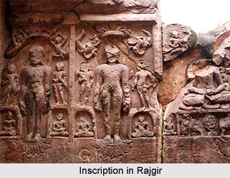
Bihar has always been an important religious center. Bihar, the holy land of Hindu, Sikhs, Muslims and Jains, is derived from Vihara (Buddhist monasteries). The state is referred to as the land of Nirvana. The holiest site for Buddhists Bodh Gaya lies in the state. Bodh Gaya is the place where Lord Buddhaattained his enlightenment. This is one of the most sacred pilgrimage places for the Buddhists. The Mahabodhi temple in Bodh Gaya is a much visited site for the Buddhist pilgrims. Rajgir in Bihar is a sacred place for both Buddhists and Jains. The Jivakamanana Monastery of this place is of interest, since it was one of the Buddha's favourite retreats. The Bodhi temple of Bodh Gaya is one of the significant places of worship for the Buddhists. Apart from being a very important Buddhist centre, it is also a noteworthy archaeological site. Devotees in large number come here every year to pay their homage. For the Hindu pilgrims there is the Sheetala Devi Temple, in Patna which is dedicated to goddess Durga. The Mangla Gauri temple of Gaya is a Hindu temple and has great mythological significance. The mausoleums and mosques in Bihar are major destinations for the Muslim devotees. The Sher Shah Masjid of Patna in Bihar is one of the many striking mosques in Bihar and a marker in Patna. The Gurudwara Bal Lila Maini in Bihar is a major site where the Sikhs come to worship.

For more, visit the link below:

Lamani Language

  The Lamani language, also known as Lambani or Banjara, is the traditional language of the Banjara or Lamani community, primarily found in ...